A groundbreaking collaboration fuses cutting-edge tech to create a real-time, physics-driven 3D model of the planet, promising to reshape defense, emergency response, and AI innovation.
- Pioneering a Dynamic Earth Replica: Aechelon Technology’s Project Orbion builds on decades of synthetic reality expertise to deliver the world’s first AI-powered digital twin, integrating satellite imagery, radar, and real-time data for unprecedented accuracy and adaptability.
- Strategic Partnerships Drive Innovation: Teaming up with Niantic Spatial, ICEYE, BlackSky, and Distance Technologies, the project combines geospatial visualization, all-weather radar, high-resolution analytics, and advanced 3D displays to overcome traditional limitations in mapping and simulation.
- Broad Applications Beyond Defense: From training AI models with ground-truth data to enabling dual-use in civilian sectors like disaster management and smart cities, Orbion sets the stage for safer, more efficient global operations in an increasingly AI-driven world.
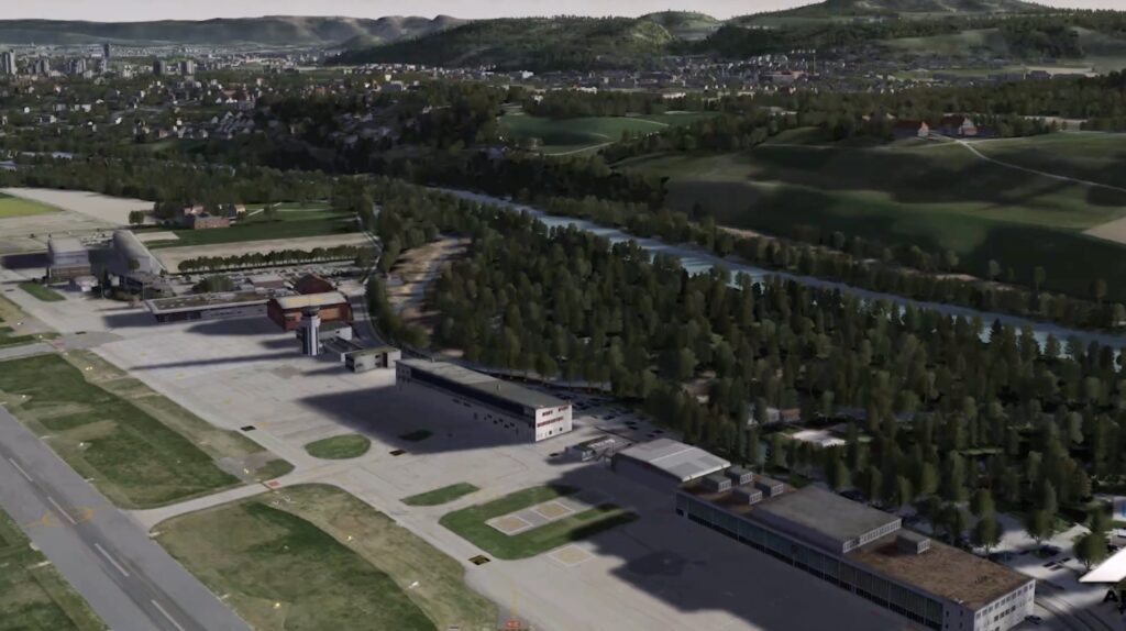
In an era where real-time data can mean the difference between life and death, Aechelon Technology is pushing the boundaries of what’s possible with Project Orbion—the world’s first AI-enabled digital twin of Earth. This ambitious initiative isn’t just a technological marvel; it’s a fusion of satellite imagery, radar, video photogrammetry, and artificial intelligence into a dynamic 3D model that updates in real time with physics-driven accuracy. For industries reliant on precise, up-to-the-minute information, such as defense and emergency response, this could be a game-changer. Imagine a platform that penetrates clouds, smoke, and darkness to provide a crystal-clear view of unfolding events, all while evolving beyond static maps and outdated datasets.

At the heart of Project Orbion lies Aechelon’s Synthetic Reality (SR) platform, a battle-tested technology that’s been honing pilot training, defense simulations, and mission rehearsals for nearly three decades. Unlike conventional mapping tools or gaming engines, SR delivers geo-specific, physics-driven realism by seamlessly integrating live sensor data. This means users can simulate scenarios ranging from urban rescues in disaster-stricken areas to monitoring bustling shipping lanes or coordinating military operations. The system’s ability to incorporate multi-sensor inputs ensures that even in adverse conditions—like heavy fog or nighttime operations—responders and agencies get an accurate, 3D picture of the ground truth. As Nacho Sanz-Pastor, Co-Founder and Chief Technology Officer of Aechelon, explains, “Aechelon has spent decades creating the most realistic synthetic environments for mission-critical defense training. The challenge has always been keeping pace with changes in the physical world and training humans and autonomous systems with realistic worldwide information. Our Skybeam™ product combines several innovative geospatial platforms with our own AI-driven, worldwide multi-sensor baseline to become a powerful new solution.”

What makes Project Orbion truly revolutionary is its powerhouse lineup of partners, each bringing specialized capabilities to the table. Niantic Spatial contributes its advanced geospatial reconstruction and visualization services, including a Visual Positioning System (VPS) that enables centimeter-level localization in GPS-denied environments. This is crucial for ground teams operating in challenging terrains where traditional satellite signals falter. Brian McClendon, CTO of Niantic Spatial, highlights the impact: “By combining our platform to scan, visualize and understand the world with Aechelon’s simulation technology, we can provide emergency and first responders the most accurate understanding of the environments in which they operate.”

Complementing this, ICEYE’s synthetic-aperture radar (SAR) constellation ensures imaging capabilities that defy weather and lighting constraints, delivering timely data even through clouds or smoke. Pekka Laurila, ICEYE’s Co-Founder and Chief Strategy Officer, notes, “Aechelon began evaluating ICEYE SAR radar imagery from orbit by fusing the data 1:1 using its Skybeam platform to update their global geospatial database. The goal was to penetrate clouds, adverse weather and smoke to ensure timely collection on the Earth for testing critical defense applications.” Meanwhile, BlackSky adds high-resolution, high-cadence Earth observation imagery paired with AI-enabled analytics, accelerating insights at machine speed. BlackSky CEO Brian O’Toole emphasizes, “BlackSky’s AI-first approach carries immense value in informing a new world of AI-enabled real-time applications – digital twins, virtual and augmented reality – that increasingly moves at machine speed.”

Rounding out the collaboration, Distance Technologies provides light field 3D display systems tailored for aerospace simulation and defense training, enhancing intuitive human-AI interactions. Urho Konttori, CEO of Distance, envisions a broader role: “This collaboration has the potential to become the operating system for human AI interaction, enabling intuitive decision making and making autonomous AI systems safer – under control.” Together, these partnerships transform Project Orbion into a unified platform that combines advanced sensing, visualization, and AI training tools, opening doors for defense, emergency response, and industrial applications while evolving simulation and AI validation far beyond traditional methods.
While defense remains the initial focus, Project Orbion’s dual-use potential extends its reach into civilian and corporate realms, making it a versatile tool for the future. By blending SR with real-world sensor data, organizations can train, fine-tune, and validate AI models using ground-truth information rather than relying solely on synthetic datasets. This shift could revolutionize industries like disaster management, where rapid, accurate simulations save lives; logistics, for optimizing global supply chains; smart cities, for urban planning and traffic management; and autonomous navigation, ensuring safer self-driving systems. In essence, Aechelon and its partners are positioning Orbion not just as a digital twin, but as a foundational infrastructure for AI systems demanding reliable, real-time situational awareness of our ever-changing planet.

As we stand on the cusp of this technological leap, Project Orbion signals a broader evolution in how we interact with and understand Earth. It’s a reminder that in a world increasingly shaped by AI, having a faithful digital mirror of reality isn’t just innovative—it’s essential for progress, safety, and informed decision-making across the globe.